

homolosine projection
- noun
- /ˌhoʊməˈlɒsaɪn prəˈdʒɛkʃən/
- Specialized
- The homolosine projection accurately represents the size of landmasses.
Examples
-
Unlike other projections, the homolosine projection preserves equal area while distorting oceans.
-
Many cartographers prefer the homolosine projection for its equal-area properties.
-
Cartographers select the homolosine projection when they want to emphasize the true size of continents.
-
The homolosine projection is often used in world maps to balance area distortions.
-
Cartographers select the homolosine projection when they want to emphasize the true size of continents.
-
The homolosine projection is often used in world maps to balance area distortions.
-
Many cartographers prefer the homolosine projection because it accurately represents the size of landmasses.
Synonyms

A way of making a flat map that keeps each place's area the same as on the globe
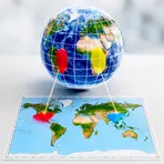
A way of drawing the world on a flat map that keeps areas the correct size
Surface Forms
Morphology
homolosine + projection
The element 'homolosine' is a specialized, technical label (not transparently analyzable by a B1 learner) while 'projection' only gives the general idea of a map depiction. Knowing 'projection' alone does not allow a learner to infer that this is a specific equal-area map that distorts oceans to preserve continental areas, so the meaning cannot be derived from the constituents.
Etymology
Homolosine projection probably gets its name from joining two parts: homolo- meaning 'equal area' and -sine from the 'sinusoidal' method. The map looks like an orange peel with cut lobes that keep continents the right size, so the projection shows 'equal area' while breaking up the oceans.

