

equal-area projection
- noun
- /ˈiːkwəl ˈɛəriə prəˈdʒɛkʃən/
- Specialized
- The equal-area projection shows countries in their true sizes.
Examples
-
The equal-area projection ensures that Africa and South America are shown in their true relative sizes.
-
Many thematic maps use an equal-area projection to accurately represent spatial data.
-
Choosing the right equal-area projection is important when comparing the area of different countries.
-
In geography class, we studied the equal-area projections used by cartographers.
-
The map displayed an equal-area projection, showing countries in true proportion to their sizes on the globe.
-
In geography class, we learned how an equal-area projection maintains the accurate area of landmasses, unlike many other map types.
-
Cartographers often choose an equal-area projection for thematic maps because it accurately represents the size of regions.
Synonyms
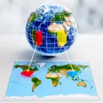
A way of drawing the world on a flat map that keeps areas the correct size
Surface Forms
Morphology
equal-area + projection
This is a straightforward adjective+noun compound: a learner who knows 'equal' and 'area' can infer 'equal-area' as 'having equal areas', and 'projection' as a way of depicting the globe on a plane, so the combined meaning is directly compositional. The construction follows a common, cross-linguistic technical naming pattern (e.g. 'proyección de áreas iguales') and would be comprehensible to a B1 learner familiar with the constituent words.
Etymology
The term equal-area projection comes from map-making: equal means 'same' and area means 'size of a place'. This way of drawing the round Earth on a flat map keeps each region's size correct, so the map shows places in the right relative sizes.

