

line of latitude
 1
3.4
1
3.4

- noun
- /laɪn əv ˈlætɪˌtud/
- To find the location of a place, you often need to know its line of latitude.
- lines of latitude and longitude
Examples
-
Here, the social studies teacher may notice immediately where a pupil needs more assistance. Thus, a pupil may need help with understanding and drawing lines of latitude and longitude in geography.
Academic text (2010) -
In this modified Mercator projection, some of the curvature of the earth is accepted into the map, bending the lines of latitude in order to reduce distortion of land areas relatively far from the equator.
Academic text (2000) -
Now it seems to me, all we have to do is simply sail along this line of latitude.
-
The lines of latitude that actually converge to a point at each pole are represented as parallel vertical lines.
Academic text (2000) -
The fourth map, which comes from the last years of the Soviet Union, introduces much more curvature in the north-south lines of latitude, which results in considerable distortion of shapes.
Academic text (2000) -
Lines of latitude and longitude are noted in the margins, showing, for example, Cape Henry at the mouth of the Bay at approximately 37 degrees, 30 minutes north latitude, comparable with today's maps.
Academic text (2007) -
The equator is the most well-known line of latitude, marking 0 degrees.
-
Sailing at a constant line of latitude can help you maintain the same climate.
Synonyms
 56
3.9
56
3.9
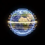
Distance north or south of the equator measured in degrees
 16
5.1
16
5.1
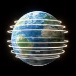
An imaginary line around the Earth that runs east to west like the equator

An imaginary horizontal line around the Earth that shows how far north or south a place is
Surface Forms
Morphology
The meaning 'an imaginary line encircling the Earth indicating position north or south' is directly and transparently derived from combining 'line' (a marker or division) with 'latitude' (angular distance north/south). This noun-of-noun composition is a straightforward, cross-linguistically common descriptive pattern, so a B1 learner who knows both constituents will readily infer the MWE's meaning.
Etymology
Line of latitude comes from the image of imaginary lines circling the Earth like belts; each line of latitude runs east–west and measures how far you are from the 'equator'. That's why a line of latitude tells your position 'north' or 'south' of the 'equator'.