

isogonal line
- noun
- /ˌaɪsəˈɡoʊnəl laɪn/
- Specialized
- The isogonal line on the map shows where the magnetic declination is the same across different regions.
Examples
-
Navigators often use an isogonal line to correct for compass variations while plotting courses.
-
The isogonal line represents areas with equal magnetic declination.
-
By following an isogonal line, pilots can ensure accurate directional readings throughout their journey.
-
Many isogonal lines can be seen on a magnetic map.
-
Pilots rely on an isogonal line to maintain accurate navigation by ensuring consistent magnetic declination during their flight.
-
The isogonal line depicted on the map indicates regions where the magnetic declination remains constant, which is crucial for navigation.
-
Using an isogonal line helps sailors adjust their compasses for accurate course plotting across different areas.
Synonyms

A line on a map showing places where compasses point the same amount away from north
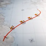
A line on a map connecting places with the same difference between magnetic north and true north
Surface Forms
Morphology
isogonal + line
Although 'line' is a transparent, common word, the modifier 'isogonal' is a specialized, low-frequency technical term (and not decomposable to familiar English morphemes for a B1 learner). Understanding the phrase requires knowledge of the technical meaning ('equal magnetic declination' or the Greek root 'iso-'/'-gonal'), so a learner who only knows the surface words would not be able to derive the MWE's meaning.
Etymology
Isogonal line is a line on the Earth that joins places where a compass points the same amount away from true north. This means the compass error, called 'magnetic declination', is the same along the line, so following an isogonal line helps navigators know where their compass readings match.

