

photogrammetry
 1
8.5
1
8.5

- noun
- /ˌfoʊtəˈɡræmətri/
- Specialized
- Combining photogrammetry with 3D laser scanning, engineers have unparalleled accuracy and point density in the measurement of large objects.
- photogrammetry is used
Loading YouTube…
Watch on YouTubeLet's bring you back down to where Good you guys forgot we still do have that photogrammetry project that is still rendering in the background.
- Let's bring you back down to where Good you guys forgot we still do have that photogrammetry project that is still rendering in the background.
Examples
-
Simple photogrammetry was used.
Academic text (2003) -
Oblique aerial photographs and multiview photogrammetry were used to reconstruct digital elevation models of the study area before and after Hurricane Matthew.
Academic text (2018) -
The photos are uploaded to the photogrammetry software.
Blog text (27) -
As each scan is taken, it is automatically aligned to the 3D points that were generated using the photogrammetry system.
Blog text (27) -
Photogrammetry itself is a well-established science and technology; two important applications are aerial photogrammetry, widely used in mapping the earth's surface, and close-range photogrammetry, commonly used in heritage documentation and archaeology.
Academic text (2007) -
In Aluka, photogrammetry is used to provide detailed surface data for site GISs to complement the laser scan models of structures and in the creation of digital terrain models (Fig. 4).
Academic text (2007) -
The ground-truth features were identified in the oblique aerial images, and the photogrammetry software was used to compare their surveyed locations with the locations determined using the 4D SfM reconstruction.
Academic text (2018) -
Four-dimensional multiview photogrammetry, also known as structure from motion (4D SfM), provides a method for generating three-dimensional reconstructions of landscapes at two times (before and after events) using only photos and existing information for ground control points.
Academic text (2018) -
Using photogrammetry, scientists create accurate maps from aerial photographs.
-
The engineers used photogrammetry to produce detailed maps of the terrain from satellite images.
Synonyms

 1
5.8
1
5.8
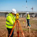
Measuring land to find exact places, distances, and angles for maps or building
Surface Forms
Morphology
photogrammetry = photogram (semi-transparent) = photo + gram + metry
The base photogram plus the scientific suffix -metry suggests a measurement-related process, but the exact technical sense is specialized.
Etymology
Photogrammetry breaks into parts that mean 'light', 'a drawing or record', and 'measure': photo- 'light', -gram 'a drawing or record', and -metry 'measure'. Think of photo as in photograph and -metry like in speedometer, so photogrammetry is measuring things from pictures, which is why it is used to make maps and 3D models from photos.