

isogeotherm
- noun
- /ˌaɪsoʊˈdʒiːəˌθɜrm/
- Specialized
- The isogeotherm indicates the depth at which the temperature remains constant throughout the region.
Examples
-
Geologists use isogeotherms to study variations in heat flow beneath the Earth's crust.
-
The distribution of minerals is often mapped along specific isogeotherm lines.
-
The isogeotherm indicates areas of similar temperature.
-
Geologists often study isogeotherms to understand geothermal gradients.
-
Geologists use isogeotherms to illustrate areas where the temperature is consistent below the Earth's surface.
-
An isogeotherm helps scientists identify the depth at which temperatures stabilize across a geological area.
-
The map displays several isogeotherm lines that connect locations with similar subsurface temperatures.
Synonyms
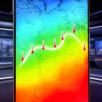
A line on a map joining places with the same temperature at the same time

A line on a map that connects points with the same value, like temperature

A line on a map that connects places with the same value, like temperature

A line on a map that joins places with the same height or temperature

A line on a map connecting points that have the same value, like temperature or pressure
Surface Forms
Morphology
isogeotherm = geotherm (opaque) = iso + geo + therm
Adding 'iso-' to the technical base 'geotherm' is a regular and fairly predictable formation, though the base itself is specialized.
Etymology
Isogeotherm breaks into three parts: iso- 'equal', geo- 'earth', and therm 'heat', like in geography and thermometer. So an isogeotherm is a line that joins places under the ground that have the same temperature.

