

geodetic
 1
9.9
1
9.9

- adjective
- /ˌdʒiːəˈdɛtɪk/
- Specialized
- For accurate navigation, it is essential to refer to a geodetic reference system such as WGS 84.
- Geodetic Survey
Examples
-
Get me a geodetic survey map of Wyoming.
-
Very near the time Beck visited the site, the Coast and Geodetic Survey designated the fire lookout there as a "geodetic survey location" and added it to their records.
Blog text (25) -
Great many ships went down in these rough waters, as you can see from this geodetic survey map.
-
We're going to need a geodetic survey map of Wyoming.
-
Shortly after the war, the U.S. Coast and Geodetic Survey, now known as NOAA,
Academic text (2007) -
For several years after 1860, Wolf was engaged in the Geodetic Survey of all Switzerland.
Blog text (29) -
In preparation for this experiment, the U.S. Coast and Geodetic Survey measured the distance between Mount Wilson and Lookout Mountain just south of Mount San Antonio (Old Baldy), nearly 22 miles, with extreme accuracy.
Academic text (1999) -
The geodetic survey revealed important information about the Earth's crust in that region.
-
Scientists are using geodetic measurements to study the effects of climate change on sea levels.
Synonyms
 4
8.9
4
8.9
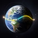
Relating to the shortest path between two points on a curved surface like the Earth
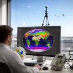
Relating to measuring and mapping the Earth's shape, size, and gravity
Surface Forms
Morphology
Etymology
Geodetic comes from Greek parts geo meaning 'earth' and daiein meaning 'to divide', so imagine dividing the Earth into parts to measure it, like in geography. So, geodetic is about measuring and mapping the Earth's shape and position.