

CRS
8.2
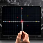
A system that maps coordinates to real places on Earth
- noun
- Specialized
:
sistema de referencia de coordenadas
- When mapping, it's essential to choose the right CRS to avoid discrepancies in data representation.
Examples
-
In GIS, a CRS ensures that spatial data aligns accurately with real-world locations.
-
The, the issue is it may be the case that once we switch to the CRS, it switches where he's cheating.
-
The CRS used for this project allows us to accurately position geographic features on the map.
Synonyms
 4
3.9
4
3.9

A way of using numbers to find the position of points on a graph or map
is a mapping framework that links spatial data to real places


 1
4.9
1
4.9
A system that uses coordinates to show positions, like GPS or a map grid
is used in mapping to connect spatial data to real-world locations
How Precise

Surface Forms
Etymology
CRS stands for the first letters of coordinate reference system, a phrase for the way maps match points on a map to the 'real world'. So a CRS tells mapping software how to place coordinates in the right location.