

Mercator's projection
- noun
- /mɜrˈkeɪtərz prəˈdʒɛkʃən/
- Specialized
- Because of the Mercator's projection, Greenland appears much larger than it actually is.
Examples
-
Sailors often use maps with the Mercator's projection to plot straight-line courses across the ocean.
-
The world map in the classroom is based on the Mercator's projection for easy navigation.
-
The Mercator's projection is widely used in navigation.
-
Many maps use Mercator's projection for its simplicity.
-
Because of the Mercator's projection, Greenland appears much larger than it actually is.
-
Sailors often use maps with the Mercator's projection to plot straight-line courses across the ocean.
-
The world map in the classroom is based on the Mercator's projection for easy navigation.
Synonyms
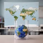
A map made by putting the world on a cylinder that keeps shapes but makes areas bigger near the poles
Surface Forms
Morphology
Mercator's + projection
A B1 learner who knows 'projection' will infer this is a type of map depiction and 'Mercator's' signals a specific named variant, so they can guess it refers to a particular map projection. However, the defining technical properties (cylindrical construction, straight meridians/parallels, and area distortion toward the poles) are specialized and cannot be derived from the constituents alone, so full meaning requires prior exposure.
Etymology
Mercator's projection comes from the idea of wrapping the globe with a paper tube and drawing the world so that travel routes become straight lines, which helps 'navigation'. That's why sailors used it, but it also makes places near the poles look much larger than they really are.

